 |
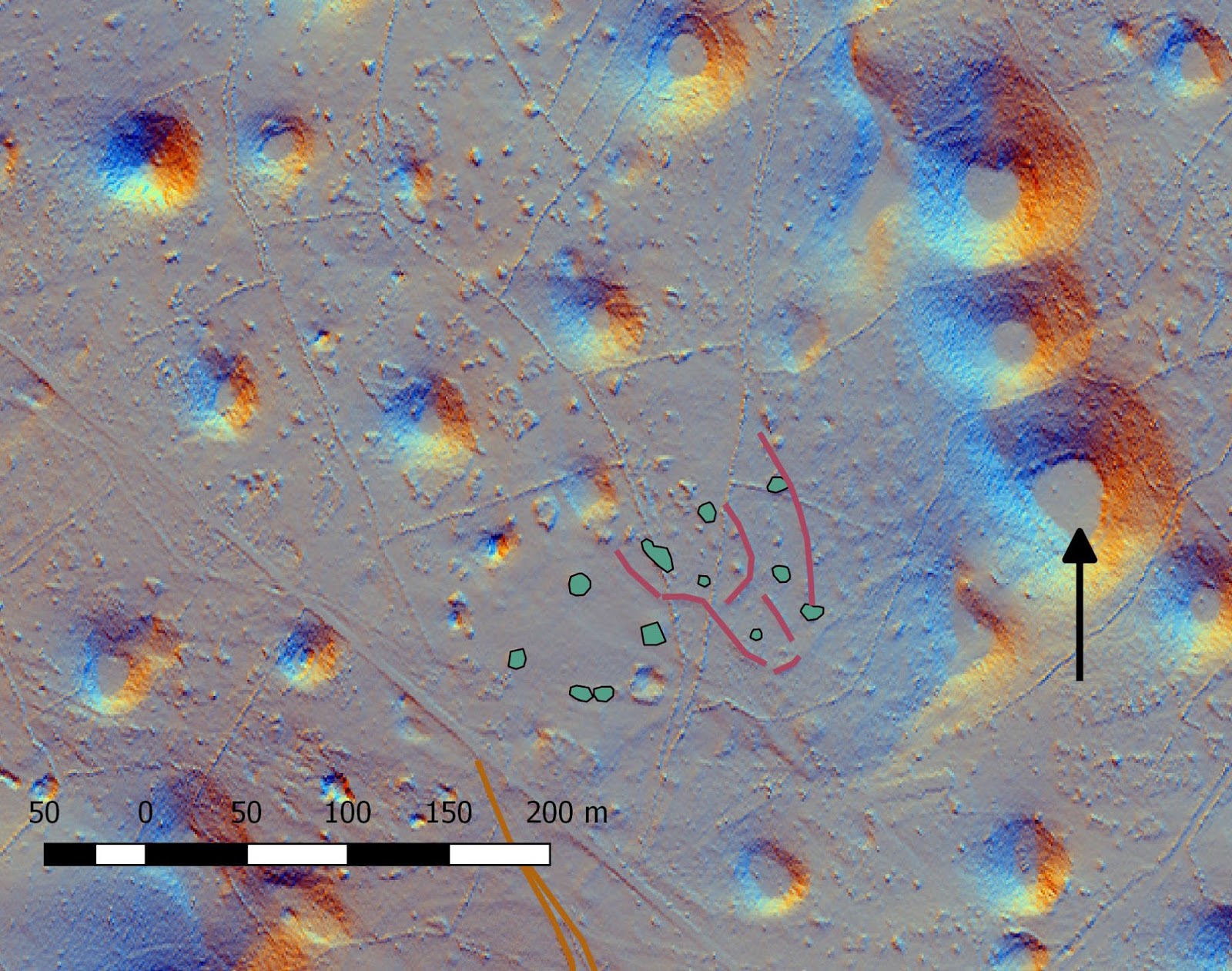
| Detail from Kosovlje maps showing the new transcription of archaeological traces and features. |
First are transcription stone mounds in the northern part of the map (blue green). I also added transcriptions of potential archaeological traces, that are drawn around these mounds.. These traces may well be the natural surface. But often in the Karst traces of such forms are potential remains of very old dry stone walls.
Link to page with interactive map of village Kosovelje.
Ni komentarjev:
Objavite komentar